| |
 |
IMPETUS Print Atlas
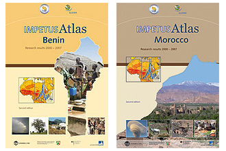
The articles of the IMPETUS Print Atlas depict important topics and results. Maps, diagrams and photos illustrate the articles within the subject areas climate, water availability, water consumption and health, geology, geomorphology and soils, landuse and land cover, society and economy.
At present the IMPETUS Print Atlases are available in English and
French.
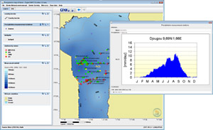
The purpose for the IMPETUS Interactive Digital Atlas (IIDA) arises from the need for publishing basic data and relevant results of the IMPETUS Project in an user friendly way. IIDA was designed as an information system, which enables the visualisation of geo-data in the form of maps with links to explinatory text, graphics and related data. Cartographic multilayer display and overlay functionality can help to understand complex issues and processes. Further results, methods, concepts and case studies are available as PDF documents.
The objective of IIDA is an open access to the information for all interested people, especially for the non-scientific public like local institutions or stakeholders. Internet and CD/DVD provide low-cost media for distribution. IIDA is a product in development with ongoing activities in integrating cartographic layers and presenting new research results.
The new software for the IIDA provides a wealth of improved tools like data filtering, changing layer styles, individual map creation or pdf export. You can change to your desired language (Sprache wechseln / changer de langue) in the File menu (Datei / Fichier).
|
|